Rains may delay some openings in national forest
Published 12:41 am Saturday, March 26, 2016
Some recreational areas in the Conecuh National Forest may open later than usual this year because of recent rains.
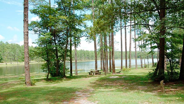
“We invite all out to the Conecuh to enjoy spring weather in the great outdoors,” said Tim Mersmann, district ranger for the Conecuh National Forest located in Covington and Escambia Counties. “Open Pond Recreation Area is a great place to start. It is open year-round for camping, boating, fishing, and picnicking. There you can access the Conecuh Trail, which is 20 miles of hiking trail through fire-maintained longleaf pine forest and bay swamp.”
Blue Lake Recreation Area with swimming beach normally opens April 1. Mersmann said opening this area may be delayed due to high water from recent heavy rains. “Right now the lake level is over the beach retaining wall creating a hazardous situation,’ he said. “We’ll need the water to come down before we open the area.” Visitors should call the Conecuh District after April 1 for status of the area.
Many recreation sites and attractions in Alabama’s Bankhead, Talladega, Conecuh, and Tuskegee National Forests are set to open soon for visitors to explore and enjoy. Visitors can plan their “Great Escape” trip by contacting a local Forest Service office, downloading the Forest Service “Alabama Great Escapes” mobile app, or visiting www.fs.usda.gov/alabama.
The Forest Service manages 28 recreation areas and more than 386 miles of trails throughout Alabama’s national forests. Group picnic shelters, developed campgrounds, shooting ranges, fishing ponds, sandy-white beaches, beautiful waterfalls, hiking trails, birding trails, horse-back riding, mountain biking, and areas for off-road vehicles are available for recreation and exercise.
Visitors will notice upgrades at national forest recreation sites and customer service advancements. This year, the public can access free and for sale maps on mobile phones using the Avenza app. Also, the “Alabama Great Escapes” mobile app provides information on recreational activities, alerts, and GPS capabilities for Iphones and Androids.
Free Motor Vehicle Use Maps are available to identify roads and trails designated for motor vehicle use throughout Alabama’s National Forests. These maps can be accessed at www.fs.usda.gov/alabama, http://www.avenza.com/pdf-maps/store (georeferenced PDFs), or a Forest Service office (printed copy).
For information about recreation sites, contact the central office in Montgomery at (334) 832-3370; or the Conecuh District in Andalusia


